31st Annual Backcountry Benefit - September 12th - Tickets Available Here!

Forecast for the Logan Area Mountains

Toby Weed
Issued by Toby Weed on
Tuesday morning, January 30, 2024
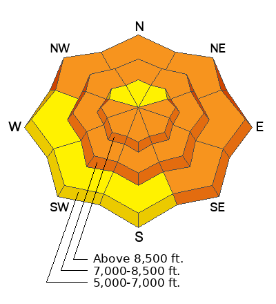
There is CONSIDERABLE danger in the backcountry, and dangerous wet avalanche conditions exist on sunny slopes at all elevations. Large natural avalanches are possible, and on many slopes, people could trigger dangerous slab avalanches up to three feet deep and a couple hundred feet wide, failing on a buried persistent weak layer.

Careful snowpack evaluation, cautious route-finding, and conservative decision-making are essential for safe travel in the backcountry today.
Low
Moderate
Considerable
High
Extreme
Learn how to read the forecast here
Special Announcements
Sign up for forecast region-specific text message alerts. You will receive messages about changing avalanche conditions, watches, and warnings...HERE.
Weather and Snow
A poor overnight refreeze, daytime heating and abundant sunshine will cause the snow to become saturated and unstable on sunny slopes at all elevations. The Spring in January heat has done significant damage, and snow conditions have, of course, become sub-par as the snow surface is now crusty or damp. The good news is we have excellent coverage and very supportable snow creating excellent "touring" conditions.

The wind is blowing lightly from the west this morning at the 9700' CSI Logan Peak weather station, and it's already 33° F. At 9500' on Paris Peak, it’s 34° F. The Tony Grove Snotel at 8400' reports 33° F and 73 inches of total snow containing 122% of average SWE (Snow Water Equivalent).

Today, expect high temperatures at 8500' over 40° F again, with sunny skies and light winds from the south-southwest. Unseasonably warm conditions are expected to continue through tomorrow, with cooling and snow starting to fall on Thursday. 6 to 14 inches of accumulation is possible on upper elevation slopes Thursday night and Friday.
Recent Avalanches
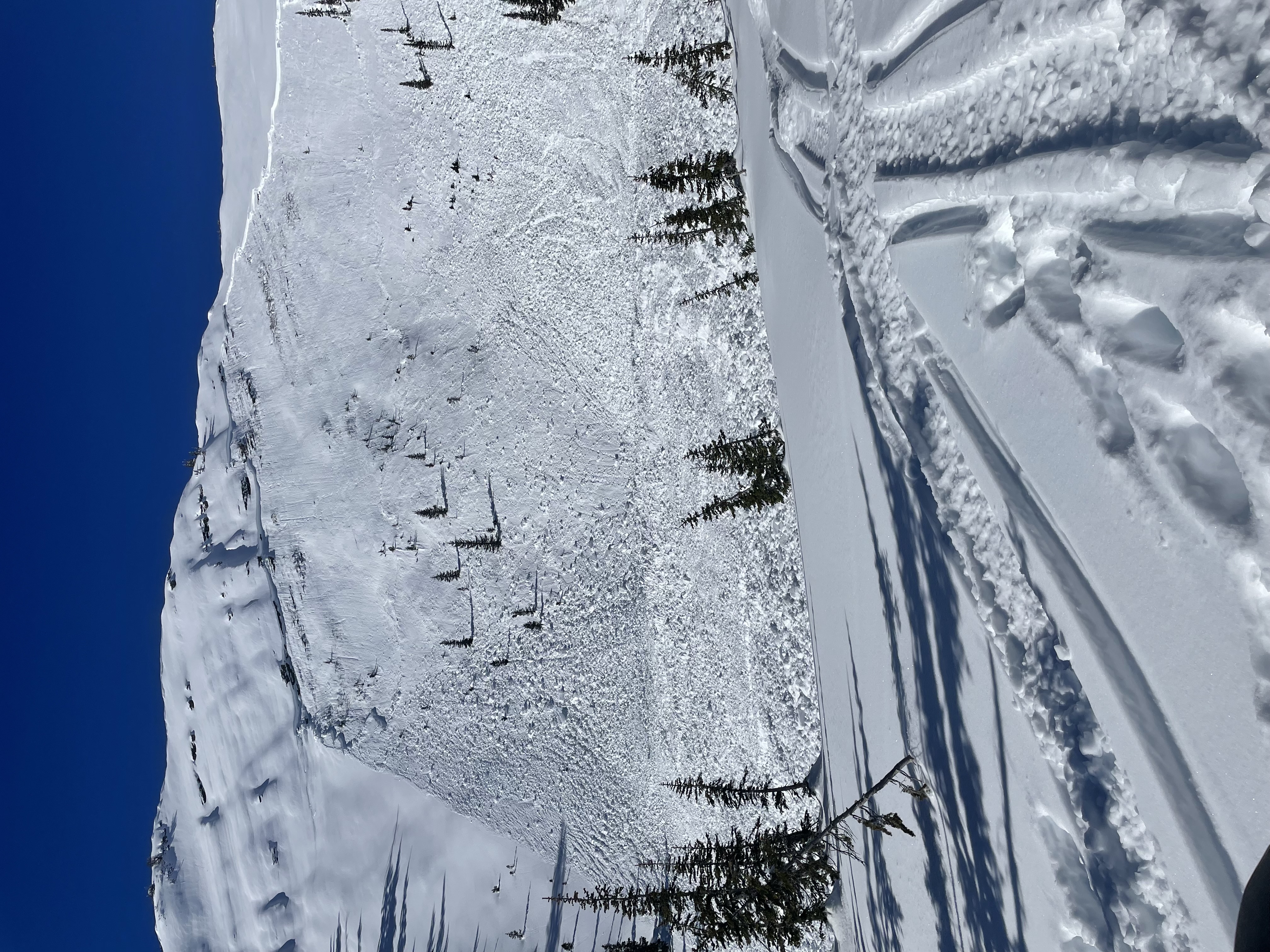
A natural wet avalanche cycle occurred Sunday due to rapid warming. The activity mainly occurred on south-facing slopes at all elevations.
  • A very large natural wet avalanche was witnessed by a professional observer in Green Canyon a little after noon on Sunday. see the report
  • A large avalanche on Wilderness Peak near Gibson Lakes in Franklin Basin was likely remotely triggered by riders on Sunday. It was reported on Monday by riders who noticed recent sled tracks in the area.
A large slab avalanche on Wilderness Peak was likely remotely triggered by riders on Sunday.
Check out local observations and avalanches HERE.
Ad
Avalanche Problem #1
Wet Snow
Type
Location
Likelihood
Size
Description
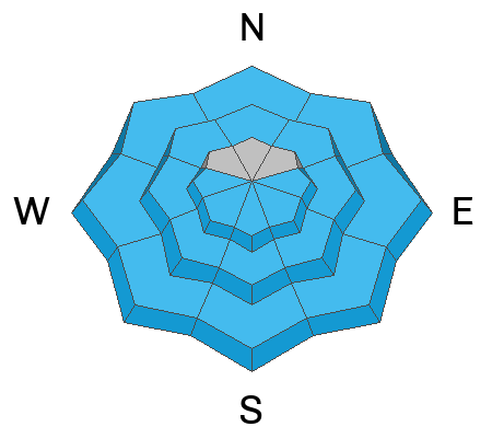
Unseasonably warm temperatures and sun will cause the snowpack to become again saturated and unstable in the day's heat.
  • If the snow surface feels sloppy and you sink in more than a few inches, move to a shadier aspect or lower-angle terrain.
  • Roller balls and pinwheels are signs that the snow is becoming unstable.
  • Avoid being below big sunny slopes and in avalanche run-out zones as the day warms.
Avalanche Problem #2
Persistent Weak Layer
Type
Location
Likelihood
Size
Description
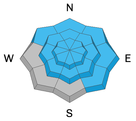
Today, human-triggered slab avalanches failing on a buried persistent weak layer could be large and life-threatening. During the last big storm, heavy snowfall and strong winds overloaded slopes plagued by a widespread persistent weak layer that formed throughout the December dry spell. The heat in recent days has softened the stiff slab layer and moistened (lubed) the problem persistent weak layer, making the snow even more unstable.
  • Avalanches could be triggered remotely, from a distance, or even from below!
  • Audible collapsing (or whumpfs), cracking, and recent avalanches are obvious signs of instability. However, these red flags may not be present when avalanches failing on a persistent weak layer occur.
Additional Information
General Announcements
-Come practice companion rescue with your backcountry partners at the Franklin Basin TH beacon training park. video HERE.
-For all questions on forecasts, education, Know Before You Go, events, online purchases, or fundraising: call 801-365-5522.
-To report an avalanche or submit an observation from the backcountry: go HERE.
-We will update this forecast by 7:30 AM tomorrow.
This forecast is from the U.S.D.A. Forest Service, which is solely responsible for its content. This forecast describes general avalanche conditions, and local variations always occur.