31st Annual Backcountry Benefit - September 12th - Tickets Available Here!

Forecast for the Logan Area Mountains

Toby Weed
Issued by Toby Weed on
Thursday morning, February 22, 2024
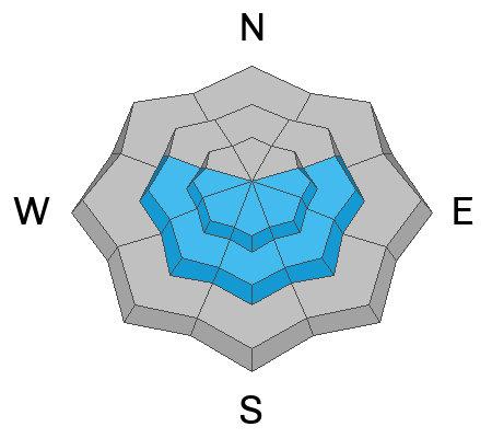
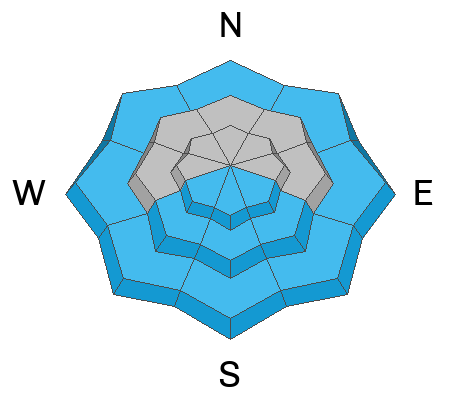
Yesterday's heavy snow elevated avalanche conditions at all elevations. The danger is CONSIDERABLE on upper and mid-elevation slopes, with human-triggered avalanches likely and natural avalanches possible on slopes steeper than 30°. Loose and soft slab avalanches of storm snow are likely. People could trigger dangerous avalanches failing 2 or 3 feet deep on a thin, persistent weak layer that sits atop a melt-freeze crust. Wet avalanches, entraining heavy piles of moist new snow, are possible in most low-elevation terrain and will become likely on sunny slopes by midday.

Careful snowpack evaluation, cautious route-finding, and conservative decision-making are essential for safe backcountry travel. Avoid being on or under steep, sunny slopes with saturated new snow.
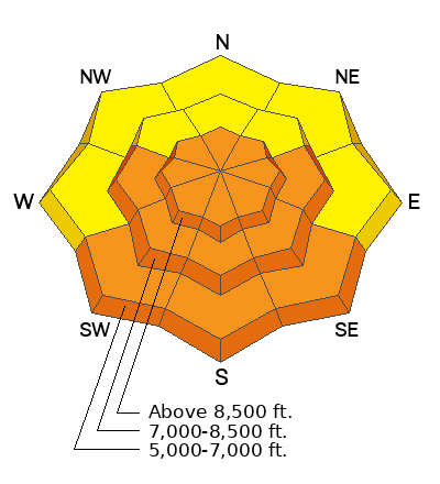
Low
Moderate
Considerable
High
Extreme
Learn how to read the forecast here
Special Announcements
We are seeking a passionate individual to join us as Executive Director of the nonprofit Utah Avalanche Center. Click here for more information.
Weather and Snow
We can expect deep powder riding conditions today, with the new snow a bit heavier at lower elevations. If the sun comes out from behind the clouds, it will affect the snow, making it sticky or slushy and prone to producing loose wet avalanches. Human-triggered and natural avalanches of storm snow are possible on slopes steeper than 30° at all elevations. Soft slab avalanches are most likely in wind-affected terrain, and small natural loose avalanches are likely on very steep slopes. Loose dry or wet avalanches overrunning a slope with significant new snow accumulation could trigger a more dangerous soft slab avalanche. In some areas, avalanches could fail on a sugary persistent weak layer buried 2 to 3 feet deep.

The Tony Grove Snotel at 8400' reports 13 inches of new snow with 1.1" SWE (snow water equivalent) from yesterday's surprise storm. It's currently 24° F, and there is 111" of total snow (with 125% of normal SWE). The wind is blowing from the northwest this morning around 15 mph at the 9700' CSI Logan Peak weather station. At 9500' on Paris Peak, winds are currently blowing from the west-northwest around 8 mph, and it's 18° F.

Today will be partly sunny in the mountains. The winds will blow from the west-northwest 8 to 10 mph. High temperatures at 8500' are expected to be around 29° F, but will be around 37° F down in Logan Canyon. Tonight will be mostly cloudy, with upper-elevation temperatures falling to around 13° F.
Tomorrow will be sunny with high temperatures up high around 29° F.
It looks like fair weather through the upcoming weekend, with the next storm impacting the zone beginning on Monday.
Recent Avalanches
Yesterday afternoon, a rider remotely triggered a 2-foot-deep slab avalanche in upper Providence Canyon (see photo below). The avalanche on a south or southeast-facing slope at around 8300' in elevation probably failed on a thin persistent weak layer. see report
Extensive roller-ball swams, small loose wet avalanches, and a few larger natural soft or perhaps wet slab avalanches in the Mt Naomi Wilderness were spotted from the valley Tuesday evening. see the report

Check out all local observations and avalanches HERE.
Ad
Avalanche Problem #1
New Snow
Type
Location
Likelihood
Size
Description
Both natural and human-triggered avalanches of storm snow or wind-drifted snow are possible at all elevations today.
  • Watch for and avoid soft wind drifts on the lee side of major ridges, corniced slopes, and in and around terrain features like cliff bands, sub-ridges, gully walls, and mid-slope rollovers.
  • Stay well away from and out from under overhanging cornices, which may break further back than expected.
  • Soft slab and loose avalanches of new snow are possible even in more sheltered terrain.
Avalanche Problem #2
Persistent Weak Layer
Type
Location
Likelihood
Size
Description
Avalanches on some mid or upper-elevation slopes may fail 2-3 feet deep on a thin layer of small-grained, sugary, or faceted snow. This thin, persistent weak layer was buried and overloaded by the productive storms over the past week. The problem appears to be more pronounced in sunny terrain where the thin layer of faceted snow sits atop a supportable melt-freeze crust.
  • Avalanches might be triggered remotely, from a distance or below.
  • Audible collapses or whumpfs and shooting cracks are obvious signs of instability, but these red flags may not be present when avalanches occur.
Avalanche Problem #3
Wet Snow
Type
Location
Likelihood
Size
Description
With partly sunny skies and above-freezing temperatures forecasted for lower elevations today, wet avalanches entraining big piles of saturated heavy new snow may become likely.
  • Roller balls, pinwheels and natural sluffs or loose avalanches are signs of instability.
  • Avoid being on or under steep sunny slopes with saturated new snow.
*If you plan on fishing the Logan River today, be mindful of what's above you. Avoid standing under steep slopes where warmth-saturated snow may slide down on top of you.
Additional Information
A remotely triggered slab avalanche occurred Wednesday afternoon in upper Providence Canyon. This likely failed on a thin, sugary, persistent weak layer.
General Announcements
-Listen to your very own Logan Zone avalanche forecasters on the UAC Podcast HERE.
-Read my recent blog about wind, drifting, and avalanches HERE.
-Sign up for forecast region-specific text message alerts. You will receive messages about changing avalanche conditions, watches, and warnings...HERE.
-For all questions on forecasts, education, Know Before You Go, events, online purchases, or fundraising, call 801-365-5522.
-To report an avalanche or submit an observation from the backcountry, go HERE.
-Come practice companion rescue at the Franklin Basin TH Beacon Training Park. It's free and open to everyone. For easy user instructions, go HERE.
-Toby will update this forecast by 7:30 AM tomorrow.
This forecast is from the U.S.D.A. Forest Service, which is solely responsible for its content. This forecast describes general avalanche conditions, and local variations always occur.