31st Annual Backcountry Benefit - September 12th - Tickets Available Here!

Forecast for the Moab Area Mountains

Eric Trenbeath
Issued by Eric Trenbeath on
Saturday morning, January 13, 2024
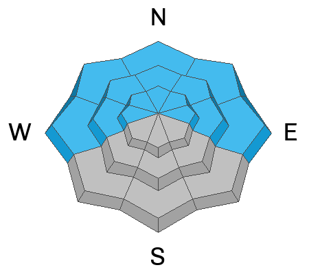
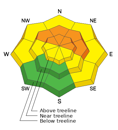
A CONSIDERABLE avalanche danger exists on steep slopes near treeline and above that face NW-N-E and human-triggered avalanches, failing on a buried persistent weak layer are likely.
A MODERATE danger exists on west and southeast aspects at all elevations, and on south aspects above treeline where you can detect recent deposits of wind drifted snow. West facing slopes also harbor a persistent weak layer of faceted snow underneath, and deeper, more dangerous avalanches are possible in these areas.
Most south facing terrain near treeline and below has LOW danger due to the effects of wind scouring and low snow conditions. Small avalanches on isolated terrain features remain possible.
Low
Moderate
Considerable
High
Extreme
Learn how to read the forecast here
Special Announcements
With the arrival of new snow, sign up for our Backcountry 101 course Jan 19, 20!
Sign up for forecast region-specific text message alerts. You will receive messages about changing avalanche conditions, watches, and warnings.
Follow us on Instagram @utavy_moab
Road Conditions: The Geyser Pass Road was last plowed on Monday. Soft snow exists. 4x4 or AWD is required.
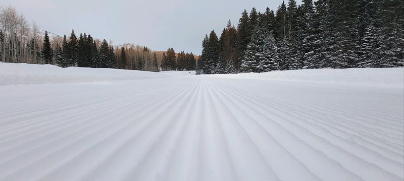
Grooming: Gavin layed down fresh corduroy into Gold Basin and over Geyser Pass yesterday.
Weather and Snow
6:00 a.m. Snow and Weather Data
24 Hour Snow 0" 72 Hour Snow 8" Season Total Snow 71" Base Depth at Gold Basin 34"
Winds on Pre-Laurel Peak: WNW 20-25 G30 Temp 14˚ F

Weather
Strong winds from the NW continue to be the story. Today, look for continued windy conditions, mostly cloudy skies, and a developing chance for snow showers by this evening. High temps will be in the mid teens at 10,000'. By tonight a strong Pacific Storm system moves into the region. Favoring points north, it nevertheless looks like we could get a decent shot of snow overnight and into tomorrow. I'm thinking 6"-8" are likely at this time.
General Conditions
Roughly 30" of snow has fallen over the past week and it has settled into a cohesive soft slab over top of our weak, underlying snowpack. The good news is that this has made the snowpack more supportable for skiing and riding. The bad news is that a persistent weak layer under this slab is now our number one problem. In our travels up around Geyser Pass yesterday, we observed several collapses or "whumphs" in the snowpack. These red flag signs of instability indicate that the weak layer has collapsed or failed underneath the slab.
In the wind zone, shifting winds have alternately stripped and loaded a variety of aspects. On northerly facing slopes, soft and hard slabs of wind drifted snow 1'-2' thick have developed exacerbating the persistent weak layer problem.
Keep those observations coming in! For a list of recent observations go here.
Snowpack and Weather Data
Gold Basin Storm Stake (10,000')
Gold Basin SNOTEL site (10,000')
SNOTEL site near Geyser Pass Winter Trailhead (9600')
Wind Station on Pre-Laurel Peak (11,400')
NWS forecast for the La Sal Mountains.
Ad
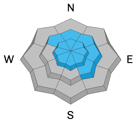
Avalanche Problem #1
Persistent Weak Layer
Type
Location
Likelihood
Size
Description
The underlying snow pack is weak, but the December drought layer (buried roughly 15 inches deep) is the primary layer of concern. This layer of weak, faceted snow formed near the surface during the December dry spell. A slab now exists on top of this persistent weak layer. Near treeline and below, storm snow over the past week has settled into a thick, cohesive slab. Near treeline and above, elevated winds have stiffened the snow and produced slabs of wind drifted snow over top of this weak layer. In our travels on Thursday, we experienced collapsing and whumphing. These red flag signs of instability are the effects of a person's weight collapsing a slab on a weak layer. The video below of an extended column test illustrates the slab's ability to propagate and produce an avalanche:
Avalanche Problem #2
Wind Drifted Snow
Type
Location
Likelihood
Size
Description
Winds continue to hammer, blowing and drifting snow on to leeward facing slopes. On steep, northerly aspects, slabs of wind drifted snow exist over top of buried weak, sugary, faceted snow. Deeper, and more dangerous human triggered avalanches are likely in these areas.
Isolated slabs of wind drifted snow may also be found on other aspects. Look for them on the leeward sides of ridge crests and terrain features such as gully walls and subridges. They are often recognizable by their smooth, rounded appearance, and cracking is a sign of instability. Old hard slabs will support your weight initially and they may sound hollow underneath. Hard slabs may lure you further down slope before breaking well above you. Avoid steep, wind drifted slopes.
Additional Information
To fulfill our mission, the UAC relies on our amazing backcountry community. Your support helps pay for the daily avalanche forecast, free awareness presentations across the state, and new tools like the new Avalanche and Observation Explorer. As we welcome the new year, please consider donating to the UAC.
General Announcements
This forecast is from the U.S.D.A. Forest Service, which is solely responsible for its content. This forecast describes general avalanche conditions and local variations always occur.