31st Annual Backcountry Benefit - September 12th - Tickets Available Here!

Forecast for the Provo Area Mountains

Drew Hardesty
Issued by Drew Hardesty on
Thursday morning, February 29, 2024
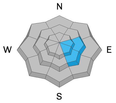
Areas of MODERATE avalanche danger will be found for both lingering and developing soft slabs of wind drifted snow today. While unlikely, it's still possible to trigger a slab avalanche 2' thick on an older buried layer from mid-Feb on east and southeast facing slopes. Cornices have become large and unruly: they are calving naturally and triggering new soft slabs on the slope below. Give them a wide berth.
The danger for wet avalanches will rise to MODERATE on all steep sunlit slopes and some low elevation shady slopes today with daytime warming.
Low
Moderate
Considerable
High
Extreme
Learn how to read the forecast here
Special Announcements
We are seeking a passionate individual to join us as Executive Director of the nonprofit Utah Avalanche Center.
Weather and Snow
Skies are partly cloudy.
Warm air aloft continues to stream in along with increasing southwest winds. All eyes are on the weekend storm.
Winds from the southwest are blowing 15-20mph with gusts to 25. 11k anemometers are spinning 25-30mph with gusts to 40. Mountain temperatures are in the low 30s.
Riding conditions will keep you honest with morning zipper crusts on the solar aspects and endless wind whales of snow without form or pattern. (Tremper photo below)

For today, we'll have partly cloudy skies with mountain temperatures rapidly rising to the mid-30s up high, the mid-40s down low. And this may be underdone. Winds will blow from the southwest and only increase as the day wears on. I expect to see 30-35mph wind speeds with gusts to 50mph by the afternoon. A large scale, slow, churning Pacific storm will move into the state tomorrow and last through Monday. Light to moderate precipitation will begin tomorrow, preferentially favoring the Ogden and Logan area mountains with an initial rain/snow line of up to 8000' in the central Wasatch and a bit lower to the north. Winds will be strong from the southwest. A sharp cold front crashes through Saturday afternoon, dropping snow to the valleys. Pulses of heavy snow can be expected through late Sunday with showers possibly continuing through late Monday. 15-30" of snow isn't out of the question with - again - the Logan and Ogden areas favored. Snow-transporting-winds will be a factor through late Sunday.
Another storm possible for Wednesday night.
Recent Avalanches
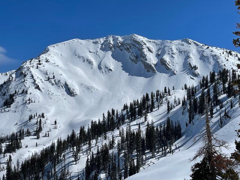
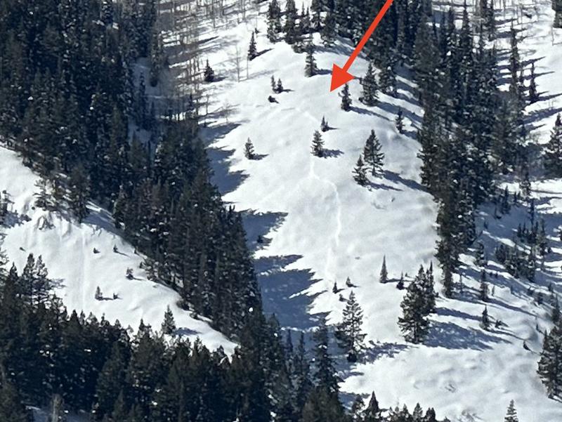
With clearing, observers noted interesting wind-driven natural avalanches from Tuesday in upper east facing Miller Hill of American Fork and Trent spotted another one failing on an older weak layer in the mid-elevations near Forest Lake of AF.
Ad
Avalanche Problem #1
Wind Drifted Snow
Type
Location
Likelihood
Size
Description
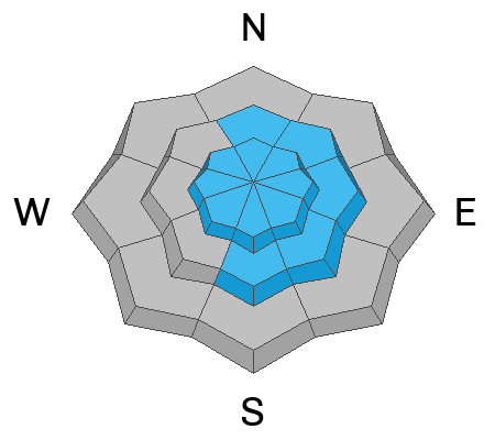
Lingering soft and occasional hard slabs may still be triggered in localized terrain. Natural settlement will have healed many of Tuesday's wind-driven slabs of snow, but you'll still be able to pry one out in steep avalanche prone terrain. The key word for these lingering wind slabs is spatial variability - each slope needs to be assessed individually, owing to the strong and erratic winds. Low elevations cannot be ignored.
There's no rest for the wicked, as we can expect to see an additional batch of soft slabs with today's increasing winds from the southwest. These fresh wind drifts will be more likely found in terrain with an easterly component.
Avalanche Problem #2
Wet Snow
Type
Location
Likelihood
Size
Description
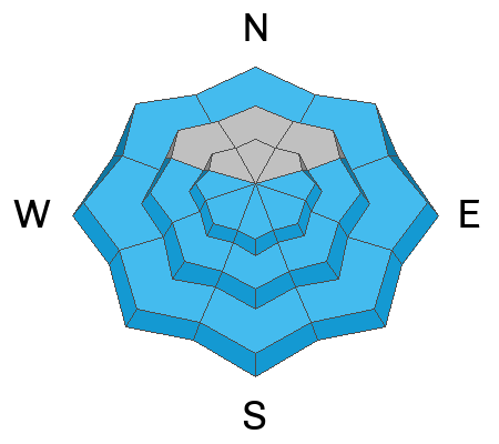
Do not underestimate the wet avalanches today. Temps will ramp up into the mid-30s up high and the upper 40s down low. It'll be a bit of a dance with the cloud cover, but I am picturing enough sun to become a problem.
So I expect to see wet loose avalanches run naturally in steep sunny terrain today. Some of these will possibly trigger pockets of slab avalanches on their way down and leave impressive debris piles in the aprons. The wet avalanches will begin on east and then south and then westerly facing terrain. Damp wet avalanches may also be triggered in low elevation northerly terrain.
Travel Advice - Do Not be on or underneath steep avalanche terrain when the snow becomes wet and unstable today with sun and heating. Wet avalanches, while slower than their dry counterparts, can be more difficult to escape and set up like concrete in the runout zones.
Avalanche Problem #3
Persistent Weak Layer
Type
Location
Likelihood
Size
Description
A weak facet/crust layer buried by the Valentine's Day storm led to a number of slab avalanches on solar aspects (primarily east and southeast facing aspects at the mid and upper elevations). This layering has become increasingly stable and we are removing this as a problem from the SL mountains but keeping it in the Provo region. Mark and Trent went into American Fork yesterday and it's worth looking at their report and video summary. The avalanche Trent noted yesterday likely occurred within a couple of days...
General Announcements
This information does not apply to developed ski areas or highways where avalanche control is normally done. This forecast is from the U.S.D.A. Forest Service, which is solely responsible for its content. This forecast describes general avalanche conditions and local variations always occur.