31st Annual Backcountry Benefit - September 12th - Tickets Available Here!

Forecast for the Salt Lake Area Mountains

Drew Hardesty
Issued by Drew Hardesty on
Tuesday morning, January 30, 2024
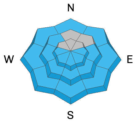
A tricky MODERATE DANGER exists on steep west to north to southeast facing slopes for triggering a 2-5' thick hard slab avalanche that fails on a persistent weak layer.
With clear skies and skyrocketing temps, the danger for wet avalanches will rise to MODERATE and possibly CONSIDERABLE on all steep sunny (as well as low elevation shady) slopes. Don't overstay your welcome in the oven.
Low
Moderate
Considerable
High
Extreme
Learn how to read the forecast here
Special Announcements
Join us for a Motorized Backcountry 101: Introduction to Avalanches class on February 2-3 down on the Skyline. Click HERE for more information.
Weather and Snow
Skies are clear.
Mountain temperatures remain inverted, with ridgetop temps in the low to mid-30s while basins and trailheads are in the low 20s. Winds are from the south and are hardly a whisper.
For today, we'll have mostly clear skies, light winds from the south and temps rising again to near 40°F up high and near 50°F down low. That's not a misprnt.
Riding conditions remain excellent in the sun and wind sheltered terrain. Solar aspects and low elevation northerlies have a crust that will soften with daytime warming. Developing surface hoar may be noted in sheltered terrain.
The Outlook: Rosy. From my vantage, the pattern looks fairly active again, with a storm Thursday afternoon through Saturday and another one lined up for early next week; each possibly with a tropical moisture tap. The southern mountains should receive preferential treatment, but we won't get left standing at the altar.
Recent Avalanches
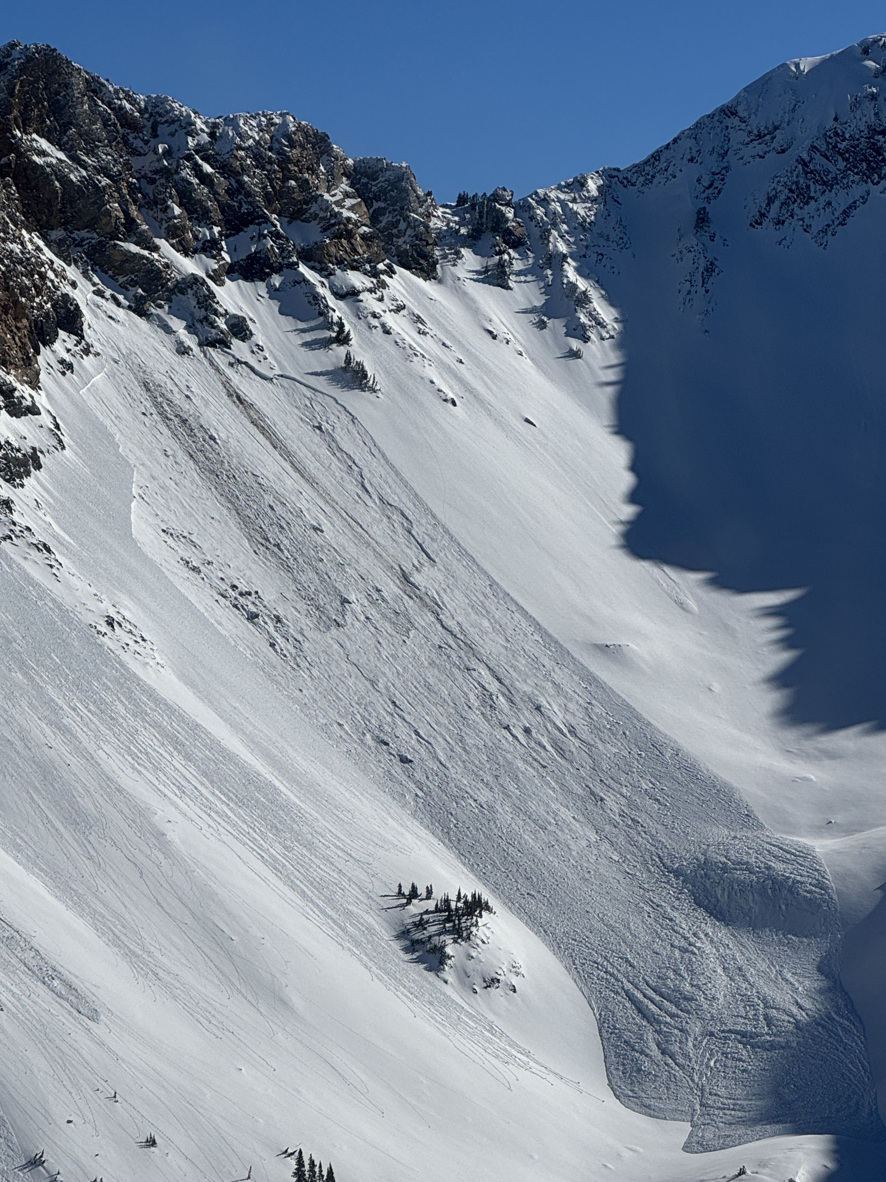
A few parties noted a large natural hard slab avalanche in west facing upper Mineral Fork (of BCC) at 10,400' yesterday. It's possible that the avalanche was triggered by a wet sluff or rockfall from above; nevertheless, it's a monster that avalanched down to the early season facets near the ground. Dimensions are a guess of 4-6' deep and 300' wide? (photo Powderbird)

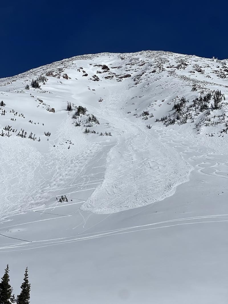
With skyrocketing temps yesterday, many wet loose and a few wet slab avalanches barreled down steep solar terrain as they became wet and unstable.

Click here for all recent observations and avalanches.
Ad
Avalanche Problem #1
Persistent Weak Layer
Type
Location
Likelihood
Size
Description
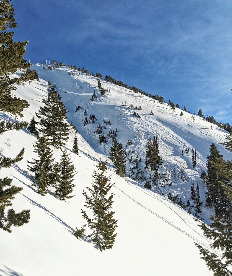
Our PWL (persistent weak layer) of facets from the December drought is generally buried 2-5' deep and is easy to find by digging down with your shovel on west to north to southeast facing slopes. It is becoming more difficult to trigger these hard slabs in deeper snowpack areas, particularly in the upper Cottonwoods. Cracking and collapsing are rare these days, but Sunday's close call on Gobbler's (S.Donovon pic) and yesterday's natural in Mineral Fork tell the tale. If you're looking for trouble, you'll probably find it in steep, thin, rocky terrain. Another tip: don't put any faith in other tracks on the slope: such is the nature of hard slabs over a persistent weak layer of faceted grains.
Avalanche Problem #2
Wet Snow
Type
Location
Likelihood
Size
Description
With clear skies and a marginal refreeze, wet avalanches will become a problem early today, starting on east then south then west and eventually some northwest facing slopes. In steep, sustained and confined terrain, some of these wet avalanches will run fast and far and easily lead to significant debris piles. In some areas, much more destructive wet slab avalanches may occur, from either being pried out by wet loose sluffs from above, or - in some cases - melt water percolating down to structural interfaces (density changes and/or facets and crusts).
Travel advice: If you see pinwheels and rollerballs and are finding the snow start to become unsupportable, move on to low angle terrain or cooler aspects.


Though not technically wet avalanches per se, GLIDE AVALANCHES may start to release in the usual terrain of Stairs, Broads, Mill B South of BCC and the north side of Raymond in MCC. Probably best to avoid this terrain for awhile until it cools off...and even then give it a few days. CORNICES, too, tend to become more tender during significant warming. Watch out.
General Announcements
This information does not apply to developed ski areas or highways where avalanche control is normally done. This forecast is from the U.S.D.A. Forest Service, which is solely responsible for its content. This forecast describes general avalanche conditions and local variations always occur.