Current Conditions: It was a real treat to have a pleasant sunny day on Tuesday. The snowpack is much more supportable now compared to last weekend. This makes travel on skis and snowmachines much easier. The wind let off on Tuesday with only moderate speeds and it still remains in the moderate speed category from the west southwest. Temperatures made it into the mid 20s, briefly dropped into the teens and single digits overnight but have rebounded with many stations pushing 30˚F.
Mountain Weather: This is an odd warm storm that started this morning. It looks like we should see somewhere between .5" and 1" of water today, most of it this morning. The snow is going to be dense. I'm thinking we should see an average of 5" of dense snow today, maybe a bit more if things really come together. The wind looks like it's going to increase in speed a bit with some stronger gusts from the west. Temperatures will remain in the mid to upper 20s.
There was one notable avalanche that occurred on Tuesday in Staker Canyon. No photos but it was described to me as fairly large. It's unsure whether it was natural or sled triggered but the wind was not actively loading slopes Tuesday so my money is on it being remotely triggered (triggered from a distance) by a snowmobiler.
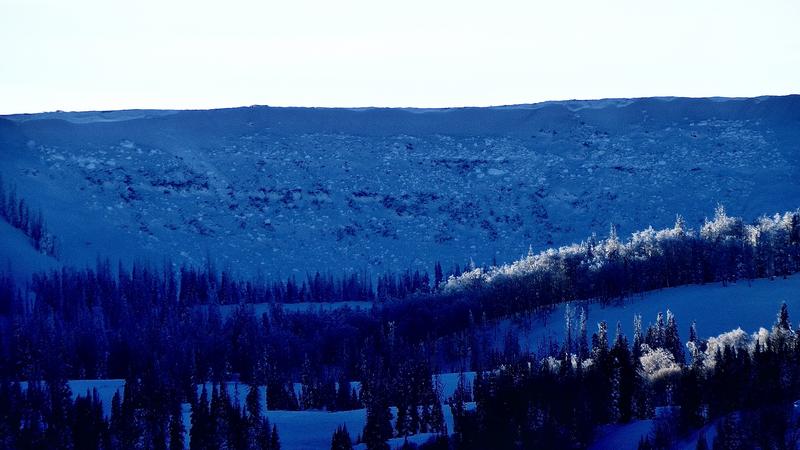
As far as other activity, we were able to get a look around and confirm many other avalanches that released during the avalanche cycle that started on Thursday. Since last Thursday, significant avalanches were confirmed in the following locations:
Staker Canyon, numerous paths with debris piles up to 20' deep
12 Mile Canyon
Numerous pockety slides along SR264 from Electric Lake to Skyline Mine
Numerous pockety slides through upper and mid Huntington Canyon
From the activity that has been confirmed, it is obvious that we went through a very widespread avalanche cycle. It is safe to assume that almost every canyon on the Manti Skyline experienced avalanche activity. We will never know the full extent as wind, snow and more expected snow will hide evidence.
Photo: Headwall of Lake Canyon, south fork - Kobernik


