31st Annual Backcountry Benefit - September 12th - Tickets Available Here!

Forecast for the Uintas Area Mountains

Mark Staples
Issued by Mark Staples on
Monday morning, March 18, 2024
Throughout the Uintas it'll be a another beautiful day to be out with a LOW danger on all slopes near and below treeline.
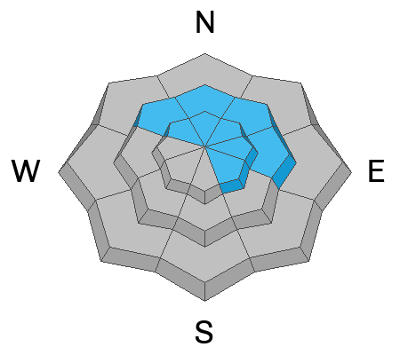
Above treeline, the danger is MODERATE where human triggered avalanches are possible. Riding these alpine slopes is doable, but watch for two things. Avoid recent deposits and drifts of snow blown by winds from the east. Also, use your best judgement and aim towards slopes where the snowpack appears deep and avoid rocky areas with a thinner snowpack.

Low
Moderate
Considerable
High
Extreme
Learn how to read the forecast here
Special Announcements
Please help support the UAC rebuild our website backend platform to ensure the ongoing security of the website and the data stored on the site by donating to our spring campaign. Save lives by making a donation today!
Weather and Snow
Winds from the east-northeast continue blowing 25 mph at upper elevations but are fairly calm at mid and lower elevations. Today winds will calm and shift a little more northerly by afternoon. Temperatures are starting in the mid to upper 20s F with a few cold spots where cold air pooled overnight, and they will quickly warm into the upper 30s and low 40s F today under bright, sunny skies.
Expect more of the same this week under high pressure, but that ridge of high pressure moves out of Utah by the end of the week and a more active weather pattern with some snow arrives next weekend.

Most sunny slopes have a good melt-freeze ice crust that should soften quickly under the strong spring sunshine. Sheltered north facing slopes still have some soft, dry powder.
Recent Avalanches
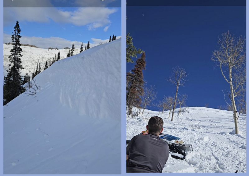
There were two notable slides on Saturday. One that a rider on a snowbike triggered and was caught in along Strawberry Ridge 2.5' deep and 300' wide.
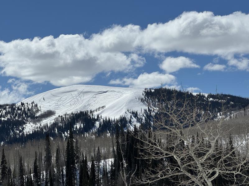
Near Currant Creek Peak, Chad spotted this large slab avalanche of wind drifted snow that was up to 4' deep and 150' wide.

For all Uinta observations and recent avalanche activity click HERE.
Ad
Avalanche Problem #1
Wind Drifted Snow
Type
Location
Likelihood
Size
Description
Winds from the east are generally done moving snow and forming hard slabs. In most places these slabs of wind drifted snow should have stabilized; however, the two slides from Saturday suggest that some will remain possible to trigger. Additionally, they will produce rather large avalanches.
The simple way to avoid this avalanche problem is to lose a little elevation and seek soft dry powder on sheltered slopes. Or get your timing just right and ride sunny slopes just as the melt freeze crust softens.
Avalanche Problem #2
Persistent Weak Layer
Type
Location
Likelihood
Size
Description
Layers deeper in the snowpack are generally deep and strong. A slight potential exists for a slide breaking at the ground. Sounds crazy, but some slopes have been shedding their snow several times this winter with avalanches breaking at the ground. These slopes have been mostly in the Chalk Creek area near ridgelines in more rocky areas at upper elevations.
If you're aiming to ride slopes in upper elevation alpine terrain - aim for slopes with a deep snowpack without drifts from recent easterly winds.
Additional Information
The Uinta weather station network was upgraded this summer and all that real-time info is found HERE. Simply click on "western Uinta" tab and then "weather stations" tab.

We are always looking for snow and avalanche observations or just general riding conditions. So... if you see something, say something. You can reach me directly at [email protected] or 801-231-2170.
Also, if you're looking for more avy education opportunities for yourself, your crew, or your club please don't hesitate to reach out to me and we'll find a presentation, class, or clinic for ya!
General Announcements

Issued 0700 on Monday, March 18th this forecast will be updated by 0700 Sunday, March 19th, 2024.
This forecast is from the U.S.D.A. Forest Service, which is solely responsible for its content. This forecast describes general avalanche conditions and local variations always occur.