31st Annual Backcountry Benefit - September 12th - Tickets Available Here!

Forecast for the Salt Lake Area Mountains

Drew Hardesty
Issued by Drew Hardesty on
Monday morning, January 15, 2024
THE AVALANCHE DANGER IS HIGH. DANGEROUS AVALANCHE CONDITIONS EXIST. AVOID BEING ON OR BENEATH STEEP TERRAIN OF ALL ELEVATIONS.
Natural and human triggered avalanches remain likely today. Remember that avalanches can be triggered at a distance or from the flats well below a slope.
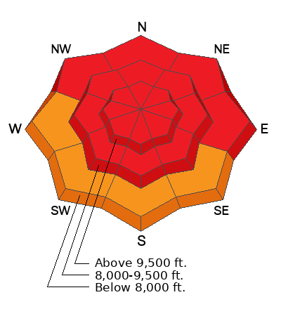
Low
Moderate
Considerable
High
Extreme
Learn how to read the forecast here
Avalanche Warning
The avalanche danger for the warning area is HIGH for the mountains of northern and central Utah and southeast Idaho, which includes the Wasatch Range...the Bear River Range...Uinta Mountains...Manti-Skyline plateau...and the mountains of southwestern Utah.
Strong winds and heavy snowfall have created dangerous avalanche conditions. Avalanches failing on a widespread persistent weak layer buried under the new snow are very likely. Avoid all avalanche terrain.
This avalanche warning is in effect from through Tuesday at 6:00am.
Weather and Snow
And it just keeps snowing. Most areas picked up an additional 4-8" (upwards of 0.62" snow water equivalent) overnight and we might squeeze another 3-6" before drying up this afternoon. Mountain temperatures are in the teens. But those winds. They picked up again overnight from the west-northwest, blowing 30-40mph with gusts to 50. The highest elevations are gusting over 100mph. Even anemometers well off the ridgelines have wind speeds of 20-25mph with gusts to 45.
Storm totals so far: (snow/snow-water-equivalent)
  • LCC: 85"/6.75" SWE
  • BCC: 66"/5.45" SWE
  • PC: 50"/4.4" SWE
  • Ogden: 55"/5.0" SWE
  • Provo: 60"/5.69" SWE
For today, we'll have continued snowfall through early afternoon. Temperatures will be in the low teens. Winds will blow from the northwest 30-40mph. We will get a bit of a break tomorrow ahead of another storm for Wednesday. Another potentially significant storm is on tap for the weekend.
With this storm, we are back on track - most areas are at or above "median" snow-water for the year.
Recent Avalanches
Large and destructive natural avalanches roared down Saturday night into early Sunday with periods of natural avalanches running yesterday mid-morning. Many of these avalanches were 2-4'+ deep and hundreds of feet wide and noted on a variety of aspects and elevations. Winds and avalanche conditions were so extreme that some roads and operations struggled to open if they opened at all.
Many old-timers are scratching their heads, wondering if they have ever seen an avalanche "here" or "there". The takehome is that avalanches are occurring in unusual terrain.
Avalanches were running within the new snow, avalanches were failing on the December layer of facets. The first will slowly heal; the second will remain as dangerous as ever.
Collapsing was noted yesterday in the upside down (higher density over lower density) new snow as well as into the old facets from December.
Since Friday, we have heard about two full avalanche burials (Main Porter, American Fork) with rumors of a third; all recovered by partners or bystanders. We've also heard of many more skiers and riders being caught and carried; again with a good outcome. Tragically, a skier was killed in an avalanche in Wyoming yesterday (Details).
Be sure to check all the avalanche activity HERE.
Ad
Avalanche Problem #1
Persistent Weak Layer
Type
Location
Likelihood
Size
Description
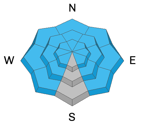
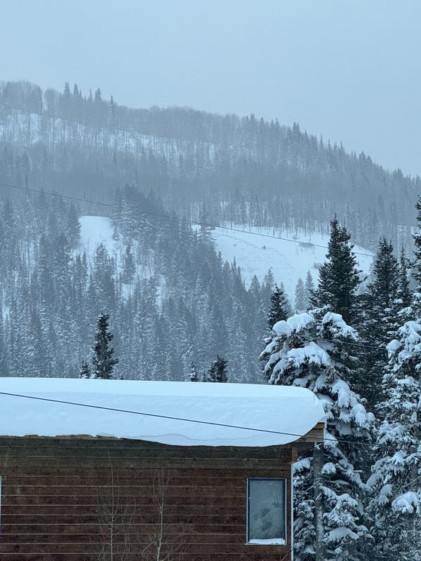
Triggering avalanches 2-4'+ down to the December layer of facets is likely today. With these continued and sustained strong winds, natural avalanches are also likely. Our poor structure exists on nearly all aspects and elevations and THERE REALLY IS NO PLACE TO HIDE AND THERE IS NO OUTSMARTING THESE CONDITIONS except to stay on and below low angle terrain. Please keep in mind that many of these avalanches are what I'd call backyard avalanches that occur near roads and trailheads (see Tony Pavlantos pic below). Observers even found poor structure and potentially conditions at 7000' in Parley's Canyon. See all the obs HERE>
Cracking and collapsing may or may not exist today.
Trend: steady.
Travel Advice: Avoid being on or beneath steep terrain.
(Tony Pavlantos photo, Mats basin near Silver Fork of BCC)
Avalanche Problem #2
Wind Drifted Snow
Type
Location
Likelihood
Size
Description
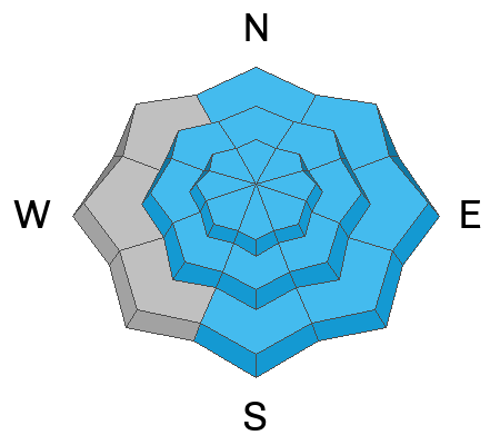
Continued and accelerating winds have drifted the snow into soft and hard slabs on predominantly north to east to south facing slopes. Terrain channeling and very strong wind speeds, however, will have deposited these slabs onto many aspects and well down the slope. Any wind slab may step down into our PWL layers, making a much more dangerous avalanche.
Trend: steady.
Travel Advice: Avoid being on or beneath steep terrain.
General Announcements
This information does not apply to developed ski areas or highways where avalanche control is normally done. This forecast is from the U.S.D.A. Forest Service, which is solely responsible for its content. This forecast describes general avalanche conditions and local variations always occur.