31st Annual Backcountry Benefit - September 12th - Tickets Available Here!

Observation: Days Fork

Observation Date
4/1/2024
Observer Name
Kelly, Treadwell
Region
Salt Lake » Big Cottonwood Canyon » Days Fork
Location Name or Route
Days Fork
Weather
Sky
Overcast
Precipitation
Light Snowfall
Wind Direction
Northwest
Wind Speed
Moderate
Weather Comments
Mostly overcast with some periods of obscured sky cover when we were in the fog. The sun popped out a couple times but no green-housing noted.
Snow Characteristics
New Snow Depth
3"
New Snow Density
High
Snow Surface Conditions
Powder
Snow Characteristics Comments
Snow surface was 3" of new snow. On north facing slopes it was deep and soft. On southerly and westerly facing slopes you could feel the melt-freeze crust under the newest snow. This only affected the travel on steeper slopes. Lower angle southerlies were good skiing.
Red Flags
Red Flags
Recent Avalanches
Cracking
Red Flags Comments
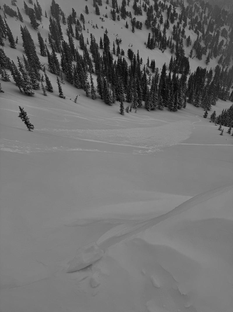
We observed a few loose dry avalanches on steep north facing terrain and some minor cracking in wind-loaded areas on southeast facing slopes.
Avalanche Problem #1
Problem
New Snow
Avalanche Problem #2
Problem
Wind Drifted Snow
Snow Profile
Aspect
Northeast
Elevation
9,900'
Slope Angle
32°
Comments
Crystals on either side of the crust approximately 3' from the surface were rounding and we had no results on this layer with compression tests.
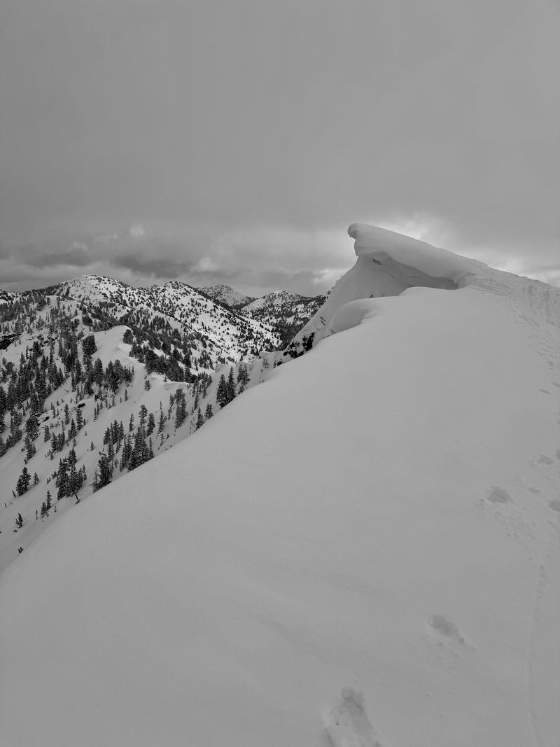
We noted some dry loose avalanches on north facing slopes at 10,400'. The picture below shows a slide that was 4"-6" deep and was 100' wide running 200' vertical feet. It appeared to have had more wind loading than some other locations. Unsure of what the trigger was. Photo 2 shows cornices near the ridge-tops.
Today, when we started the tour we had uncertainty with how sensitive the new and wind-drifted snow would be and we approached the day with the mindset of considerable for travel until we could better assess.
Today's Observed Danger Rating
Moderate
Tomorrows Estimated Danger Rating
Moderate
Coordinates