31st Annual Backcountry Benefit - September 12th - Tickets Available Here!

Forecast for the Skyline Area Mountains

Brett Kobernik
Issued by Brett Kobernik on
Saturday morning, January 20, 2024
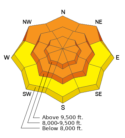
The overall avalanche danger on the Skyline is rated at CONSIDERABLE.
Human triggered avalanches remain likely.
Continue to avoid being on or below slopes steeper than 30˚.
Low
Moderate
Considerable
High
Extreme
Learn how to read the forecast here
Special Announcements
FREE AVALANCHE BEACON TRAINING
Saturday, 9am to 1pm
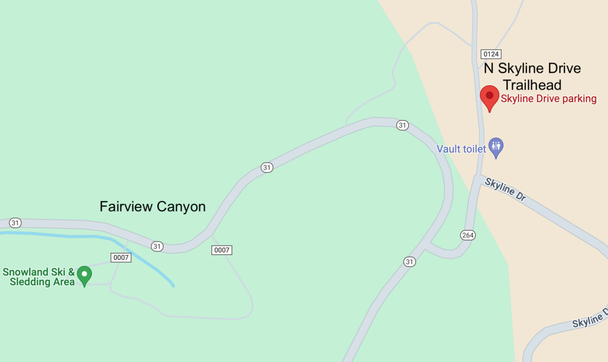
North Skyline Drive trailhead
Stop by anytime between 9am and 1pm and we'll take a half hour to an hour and teach you how to effectively use your avalanche gear. You will walk away being much more confident in using the gear.
LINK TO GOOGLE MAPS
Weather and Snow
Current Conditions: It was a pleasant day in the mountains on Friday with scattered thin high clouds, temperatures into the upper 30s and light wind. Riding conditions remain pretty decent with lots of dense, soft snow around. You'll find melt-freeze crusts on many sunny facing slopes this morning. You'll also find areas where the wind has damaged the snow surface. Overnight temperatures remained fairly warm with readings in the mid 20s.
Mountain Weather: We'll have high clouds this morning with clouds thickening up this afternoon. Temperatures will get into the upper 20s and low 30s with light southwest wind. An unsettled weather pattern is moving in that'll produce chances for light snowfall through much of next week. The first round is tonight with a trace to a few inches possible.
Recent Avalanches
No new avalanche activity was reported on Friday. However, we continue to get reports of avalanches from the natural cycle earlier in the week.
Ad
Avalanche Problem #1
Persistent Weak Layer
Type
Location
Likelihood
Size
Description
You can't trust a snowpack that has sugary facets as a base. The wise thing to do is have patience and wait for the snowpack to stabilize before getting into steeper terrain.
That said, I am seeing some signs of improvement. In areas with the deepest snowpack (Fairview Canyon/Miller Flat, 5 feet deep) I was pleased to see the buried sugar has gained quite a bit of strength and I did not get any significant results from snowpit tests. I guarantee this is not the case for all the terrain on the Skyline. Anywhere the snowpack is shallower, it is going to be weaker and still dangerous.
Here are your two main clues to watch for:
  1. Collapsing (whoomping) of the snowpack. A notable "whoomp" underneath you where you may even feel the snowpack drop an inch or two. This is a HUGE indicator of unstable snow.
  2. Trenching. If you feel your track dropping deep into the snowpack, you are probably in an area with shallower snow and, hence, weaker snow.
Slopes that have avalanched are generally safe at this point. Also, the chances for triggering an avalanche become less each day.
Bottom line, personally, I have zero tolerance for steep terrain when there is a Persistent Weak Layer present. I don't split hairs and try to outsmart it by choosing steep terrain where I think it won't be a problem. What I've learned over the years is you can't trust sugary facets. They will bite you when you think things have become stable. I've seen it time and again.
General Announcements
This forecast is from the U.S.D.A. Forest Service, which is solely responsible for its content. This forecast describes general avalanche conditions and local variations always occur.