31st Annual Backcountry Benefit - September 12th - Tickets Available Here!

Forecast for the Uintas Area Mountains

Craig Gordon
Issued by Craig Gordon on
Tuesday morning, March 12, 2024
If you're dusk patrolling keep an eye on the sky... the incoming storm may bump the hazard up slightly by late in the day-
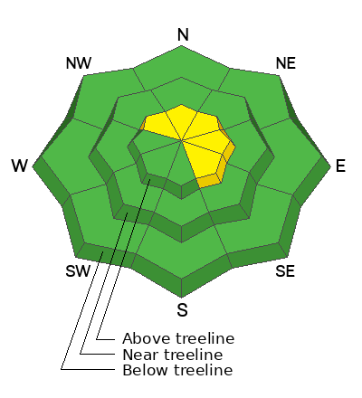
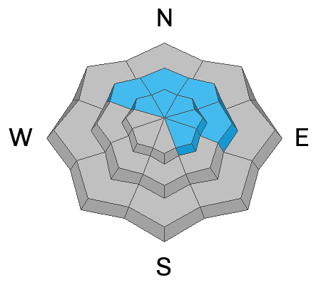
Today in the windzone above treeline, you'll find MODERATE avalanche danger. Human triggered avalanches are POSSIBLE on steep, wind drifted slopes. In addition, a slide breaking to old snow isn't entirely out of the question, especially in steep, rocky, wind drifted terrain.
Lose some elevation and head to wind sheltered terrain where you'll find generally LOW avalanche danger.

Low
Moderate
Considerable
High
Extreme
Learn how to read the forecast here
Special Announcements
Please help support the UAC website rebuild by donating to our spring campaign. Save lives by making a donation today!
Weather and Snow
Nowcast- As the main act waits in the greenroom, the warm up band delivered a quiet opening set with a little spritz of moisture and a very thin, primer coat of white paint. With thin clouds overhead, temperatures hover in the low 20's tip to tail, while winds from the south blow in the mid 20's near the high peaks. The snow surface is a bit rugged and I'd probably get a few chores done and wait for some storm snow to stack up before heading out the door.
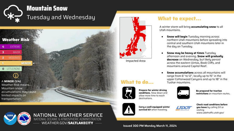
Forecast- A nice shot of snow is at our doorstep. Look for increasing clouds with snow, heavy at times, developing by late afternoon. Winds blowing from the southwest ramp into the 30's while temperatures climb to just above freezing. A cold front slides into the region overnight delivering a reinforcing shot of unsettled weather, along with a chance of thundersnow! Storm totals in the 4"-8" range by sunrise Wednesday seem reasonable.
Furturecast- A short-lived break in the action is slated for Wednesday morning with an additional round of snow settling in by about suppertime. Another couple inches are expected overnight with lingering snow showers on tap for Thursday morning. Now for the buzzkill... as our storm dives to the four corners, we may see snow torching, moonscape sculpting winds blowing from the east and northeast develop. Gotta keep on eye on that one. High pressure builds to round out the work week.

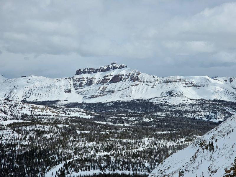
Snowpro Joey Manship shares an image and a view from God's Livingroom. Yup... the Uintas offer a phat, white snowpack on a go-anywhere base
A mid week reset and Winter Weather Advisory is on tap.
Recent Avalanches
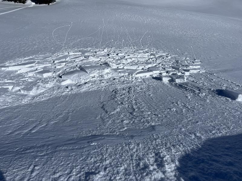
Over the weekend, Ted Scroggin... our main man with the western Uinta plan, triggered a shallow wind slab or two on a small test slope near Bald Mountain.

And I found ginormous, cornice which can break unpredictably.

For all Uinta observations and recent avalanche activity click HERE.
Ad
Avalanche Problem #1
Wind Drifted Snow
Type
Location
Likelihood
Size
Description
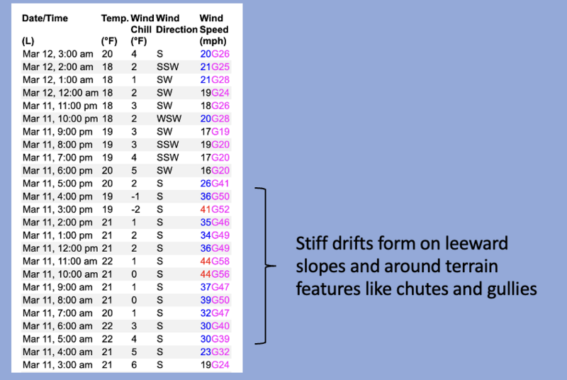
Strong winds from the south and southwest ramped up yesterday morning, continuing through a good portion of the day, whipping up a fresh batch of stiff, yet mostly stubborn drifts. However, it never ceases to amaze me how winds can channel snow through terrain features and load slopes in unusual places. I suspect most drifting occurred on the leeward side of upper elevation ridges, but be on the lookout and avoid any fat, rounded piece of snow, especially if it sounds hollow like a drum.
Avalanche Problem #2
Persistent Weak Layer
Type
Location
Likelihood
Size
Description
Mark found deep, strong, and stable snow on Saturday during his travels near treeline.
A few Black Swans preen in our snowpack, but all the right elements for this unlikely event need to align perfectly. Think... steep, rocky, wind loaded slopes, in the windzone that have avalanched multiple times this year. Or in other words... you'd really have to get unlucky. Rather than try to out-guess the snowpack, just keep it simple and avoid places where you think there's a good chance of hitting rocks which in turn are likely places to trigger a deep, dangerous avalanhche.
Additional Information
The Uinta weather station network was upgraded this summer and all that real-time info is found HERE. Simply click on "western Uinta" tab and then "weather stations" tab.

We are always looking for snow and avalanche observations or just general riding conditions. So... if you see something, say something. You can reach me directly at [email protected] or 801-231-2170.
Also, if you're looking for more avy education opportunities for yourself, your crew, or your club please don't hesitate to reach out to me and we'll find a presentation, class, or clinic for ya!
General Announcements

Issued at 0400 on Tuesday, March 12th this forecast will be updated by 0700 Wednesday, March 13th, 2024.
This forecast is from the U.S.D.A. Forest Service, which is solely responsible for its content. This forecast describes general avalanche conditions and local variations always occur.