31st Annual Backcountry Benefit - September 12th - Tickets Available Here!

Forecast for the Uintas Area Mountains

Craig Gordon
Issued by Craig Gordon on
Wednesday morning, March 13, 2024
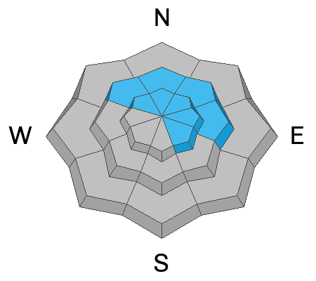
In the windzone above treeline, you'll find MODERATE avalanche danger. Human triggered avalanches are POSSIBLE on steep, wind drifted slopes around the compass. In addition, a slide breaking to old snow isn't entirely out of the question, especially in steep, rocky, wind drifted terrain facing the north half of the compass.
Lose some elevation and head to wind sheltered terrain where you'll find generally LOW avalanche danger.

Low
Moderate
Considerable
High
Extreme
Learn how to read the forecast here
Special Announcements
Please help support the UAC website rebuild by donating to our spring campaign. Save lives by making a donation today!
Weather and Snow
Nowcast- Winds shifted to the northwest right around sunset, ushering in last night's cold front and a quick hitting storm which delivered 4"- 6" of medium density snow across the range. Partly cloudy skies at o'dark thirty suggest a break in the action along with cooler temperatures registering in the teens and low 20's. Winds currently blow 20-30 mph from the west and northwest near the high peaks, but are beginning to relax somewhat. Last nights refresh is a welcome addition to help cushion old snow surfaces and low angle terrain is gonna be the ticket to avoid bottom feeding.
Forecast- Expect a few scattered snow showers throughout the day and cooler temperatures which hover in the upper teens. Winds remain relatively well-behaved, blowing in the 20's from the west and northwest.
Futurecast- A clearing trend is on tap for Thursday as our recent storm dives to the four corners. The bad news is... we will most likely see strong east and northeast winds as a result and that'll nuke a vast majority of our alpine terrain.

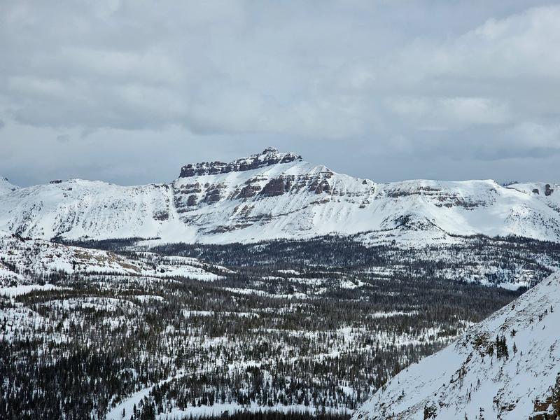
Avy-savvy, Joseph Manship shares an image and a view from God's Livingroom. Yup... the Uintas offer a phat, white, and mostly stable snowpack on a go-anywhere base
Recent Avalanches
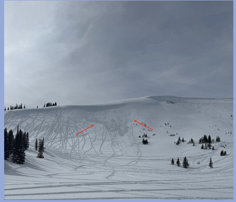
No recent avalanche activity since the weekend-
My colleague and fellow snow-pro Dave Kelly stomped around the Moffit environs over the weekend. Dave reports stable conditions with the only news worthy avalanche activity occurring on Double Hill in the image above.

And I found ginormous, cornice which can break unpredictably.

For all Uinta observations and recent avalanche activity click HERE.
Ad
Avalanche Problem #1
Wind Drifted Snow
Type
Location
Likelihood
Size
Description
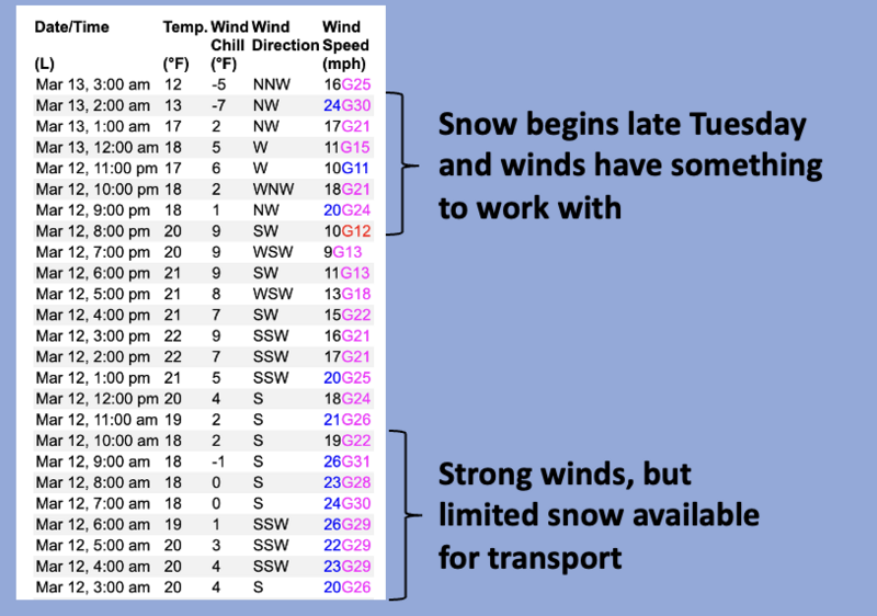
A 24 hour data dump from Windy Peak shows a clear shift in wind direction as last nights cold front slides through the region.
It's been breezy the past 24 hours, but overnight, winds conspire with fresh snow and now have something to work with, forming shallow drifts on nearly all quadrants of the compass. Breaking at or below our skis, board, or sled today's main avalanche problem is straight-forward and predictable. While I suspect most drifting occurred on the leeward side of upper elevation ridges, but be on the lookout cross-loading in chutes and gullies and avoid any fat, rounded piece of snow, especially if it sounds hollow like a drum. Lose the wind... you lose the problem.
Avalanche Problem #2
Persistent Weak Layer
Type
Location
Likelihood
Size
Description
Mark found deep, strong, and stable snow on Saturday during his travels near treeline.
Our snowpack is mostly bomb dot com, but a few Black Swans preen on the shores, though all the right elements for a catastrophic avalanche need to align perfectly. Think... steep, rocky, wind loaded terrain in the windzone, especially slopes that have avalanched multiple times this year. Or in other words... you'd really have to get unlucky. Rather than try to out-guess the snowpack, just keep it simple and avoid places where you think there's a good chance of hitting rocks which in turn are likely places to trigger a deep, dangerous avalanche.
Additional Information
The Uinta weather station network was upgraded this summer and all that real-time info is found HERE. Simply click on "western Uinta" tab and then "weather stations" tab.

We are always looking for snow and avalanche observations or just general riding conditions. So... if you see something, say something. You can reach me directly at [email protected] or 801-231-2170.
Also, if you're looking for more avy education opportunities for yourself, your crew, or your club please don't hesitate to reach out to me and we'll find a presentation, class, or clinic for ya!
General Announcements

Issued at 0400 on Wednesday, March 13th this forecast will be updated by 0700 Thursday, March 14th, 2024.
This forecast is from the U.S.D.A. Forest Service, which is solely responsible for its content. This forecast describes general avalanche conditions and local variations always occur.